Department of Agriculture, Environment and Rural Affairs Department of Agriculture, Environment and Rural Affairs An Roinn Talmhaíochta, Comhshaoil agus Gnóthaí Tuaithe Depairtment o' Fairmin, Environment an' Kintra Matthers

Main navigation

  • Home
  • Topics
  • Publications
  • Consultations
  • Contact

Translation help

Translate this page

Select a language

  • Arabic — عربي
  • Chinese (Simplified) — 中文简体
  • Chinese (Traditional) — 中文繁體
  • Dutch — Nederlands
  • Filipino — Filipino
  • French — Français
  • German — Deutsch
  • Hungarian — Magyar
  • Irish — Gaeilge
  • Italian — Italiano
  • Latvian — Latviešu
  • Lithuanian — Lietuvių kalba
  • Polish — Polski
  • Portuguese — Português
  • Romanian — Română
  • Russian — Русский
  • Slovak — Slovenčina
  • Spanish — Español
  • Ukrainian — Українська
  • Neagh Bann River Basin District

    Topics:
    • Water, 
    • River Basin Management

    The Neagh Bann river basin district (NB RBD) covers an area of around 5740 km2. It includes all of County Armagh, large parts of Counties Antrim, Londonderry, Down and Tyrone and a small area County Fermanagh.

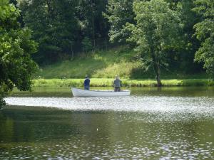
    Fishermen in Dungannon Park
    Fishermen in Dungannon Park

    The principle river system is the Bann, with its tributaries the Moyola, Ballinderry, Blackwater, Six Mile Water and Main. The Newry river system drains into Carlingford Lough. Lough Neagh, located in the centre of the district is the main lake, with other smaller ones include Lough Fea, Portmore, Ross and Beg. This district has a limited coastline to the north where the River Bann enters the Atlantic and to the south where the Newry system enters Carlingford Lough.

    • NB RBD first cycle river basin management plan summary 2009 – 2015
    • NB RBD second cycle river basin management plan summary 2015 - 2021

    A list of documents to support the second cycle plans can be viewed below. The documents can be found using our publication search facility.
    second cycle RBMP supporting documents

    The baseline second cycle 2015 Classification results showed the 26% of the surface water bodies in this RBD were at good or better status. Of the remaining, 57% were moderate, 11% poor, 4% bad and 2% not classified. The majority of individual elements monitored are at good status however the ‘one out, all out’ rule for classification i.e. status is determined by the lowest from all the standards that are assessed, has led to many not achieving good. Groundwater bodies unlike surface waters are classified as good or poor for quantitative and chemical status, which combine to produce an overall. There are 16 groundwater bodies in the NB RBD, 6 are at overall good status.

    By 2021 we aim to increase the number of surface water bodies achieving good or better status to 68%.

    The interactive web map allows the quality of the water bodies to be viewed.

    • NIEA Catchment Data Map Viewer

    This area has 2 dedicated Catchment Management Officers who cover the catchments within the NB RBD draining into and out of Lough Neagh – Moyola, Ballinderry, River Blackwater, Upper Bann, Six Mile Water, Braid and Main and Lower Bann. Catchments related to the Newry System and draining into Carlingford Lough are covered by the Catchment Management Officers in the North Eastern district.

    Wendy Craig
    Mert Thompson

    The Catchment Officers continually work with groups of stakeholders - details on becoming involved can be obtained by contacting them.

    Related content

    • Acid Sensitive Risk Areas for Forestry Activities
    • Delivery and public participation
    • Groundwater Karst Data
    • Lough Neagh Catchment Map
    • NI Water Framework Directive Statistics
    • NIEA Catchment Data Map Viewer
    • North Eastern River Basin District
    • North Western River Basin District
    • Quantifying the hydrological effect of woodland creation in the Camowen and Drumragh catchments, Omagh, Northern Ireland
    • River Network Contribution by Local Management Area
    • Shellfish Water Protected Areas
    • Status of Rivers and Lakes
    • WMU Spatial Datasets
    Share this page Share on Facebook (external link opens in a new window / tab) Share on X (external link opens in a new window / tab) Share by email (external link opens in a new window / tab)

    Department footer links

    • Crown copyright
    • Terms and Conditions
    • Privacy
    • Cookies
    • Accessibility
    • The Northern Ireland Executive
    • The Executive Office
    • Department of Agriculture, Environment and Rural Affairs
    • Department for Communities
    • Department for Education
    • Department for the Economy
    • Department of Finance
    • Department for Infrastructure
    • Department for Health
    • Department of Justice
    • nidirect.gov.uk — the official government website for Northern Ireland citizens