Major research project to assess change in the Northern Ireland countryside has commenced

DAERA is pleased to announce that it has awarded a contract to deliver a repeat of the Northern Ireland Countryside Survey (NI Countryside Survey) to the UK Centre for Ecology and Hydrology, in collaboration with the Agri-food and Biosciences Institute and Queens University Belfast. This contract forms part of the monitoring and evaluation of the Environmental Farming Scheme and will also help inform a range of policy development and reporting obligations relating to the environment.
The current contract will revisit each of the 288 randomly selected quarter kilometre survey squares located throughout NI, which were last surveyed in 2007. Following a survey pilot conducted in Sept 2022, the contractor will be contacting farmers and landowners in NI Countryside Survey squares to ask permission for field surveyors to access their land to carry out detailed mapping of habitats, record vegetation and take soil samples. The majority of this field survey work will be carried out in 2023/24, followed by a repeat survey of vegetation in 2026/27.
Further information on the NI Countryside Survey methodology and history, as well previous reports can be found in the links at the bottom of this page. A link to the Great Britain Countryside Survey can be found here.
Any queries relating to NI Countryside Survey should be directed to EFS.MEF@daera-ni.gov.uk
What is the NI Countryside Survey?
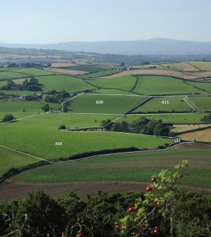
The NI Countryside Survey is a statistically robust sample of the NI countryside which assesses the area, distribution and species composition of land cover and habitat types and provides reliable estimates of how they change over time. This is accomplished by surveying a stratified random selection of quarter kilometre squares; the location of which are kept confidential to maintain the scientific integrity of the survey methodology.
Results provide a consistent basis for analysis of the effects of countryside, agricultural and other policies, pressures or drivers of change upon the fabric of the NI countryside. Change is tracked using repeat surveys.
The baseline survey was carried out between 1986 and 1991. A resurvey of the baseline was carried out in 1998, referred to as NI Countryside Survey 2000. The second repeat survey assessed habitat change between 1998 and 2007 and is referred to as NI Countryside Survey 2007. Where appropriate, findings are combined with Countryside Survey data from Great Britain to produce an overall picture of change at a UK scale.
How is the NI Countryside Survey carried out?
The NI Countryside Survey is based on the NI Land Classification – a multivariate classification of 1km squares in NI, which groups similar squares together on the basis of climate, elevation, topography, vegetation, hydrology, geology, soils and settlement patterns.
There are 23 NI land classes, and a stratified random sample of quarter kilometre squares were selected for field survey, so that they were representative of the full range of landscape variation. This provides a statistically robust sample of NI, which can be used to extrapolate estimates of habitat extent at a NI scale using a series of algorithms.
The same quarter kilometre squares are surveyed using the same methodology over time, therefore change can be assessed at a NI scale. Field mapping is carried out using Primary Habitat classification, which is defined by vegetation structure and species composition and is a habitat classification unique to NI Countryside Survey. The Primary Habitats (and field boundary types) recorded are aggregated into more general Broad Habitats. Broad habitats represent a classification of the terrestrial environment developed for the UK Biodiversity Action Plan, and allow for habitat comparison within the UK.
For NI Countryside Survey, changes are presented at the Primary Habitat level as well as Broad Habitat level. Whilst Broad Habitat reporting is a useful classification of habitats for reporting purposes, more detailed exploration of the results is possible at the Primary Habitat scale.
NI Countryside Survey reports
Information on previous NI Countryside Surveys can be found at History of NI Countryside Survey
Previous reports can be accessed at the NI Countryside Survey reports repository
A summary of previous NI Countryside Survey results can be accessed at NI Countryside Survey 2000 results and NI Countryside Survey 2007 results.

