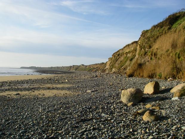
Kilkeel Steps is a special place because of its earth science interest. The area provides access to important features formed toward the end of the last ice age.
The soft cliffs are made up of sand, gravel and mud that were deposited as the main ice sheet was breaking up, around 20,000 years ago. These deposits cover the whole Mourne Plain, but at Kilkeel Steps particular features have been exposed.
The sediment was laid down in an open sea area surrounded by ice. Mud and other more coarse material such as sand, gravel and cobbles were carried to the sea by the ice to form a layer at the bottom of the sea.
The very bottom layers of mud contain pieces of rock that were carried south by the ice from as far away as Ailsa Craig, but most of the mud contains rocks from nearby, likely from as near as Carlingford Lough.
When the sea level dropped, the mud was exposed on the surface and rivers cut into it. This formed troughs that were then filled with sand, mud, gravel and cobbles when the sea level rose again. Microscopic fossils have been found in these sediments that have helped date the deposits.
Related articles
- ASSI Guidance for Public Bodies/Competent Authorities
- Coastal Areas of Special Scientific Interest
- Conservation Management Plans (CMPs)
- European Marine Sites - Marine Special Areas of Conservation and Special Protection Areas
- Introduction to Conservation Management Plans (CMPs) for Northern Ireland’s Special Areas of Conservation
- Marine Conservation Zones
- Marine Protected Areas
- Marine Ramsar sites
- Portrush Coastal Zone
- Special Areas of Conservation
- Special Areas of Conservation for Harbour porpoise
- Special Protection Areas
