Why is this monitored?
The evidence gathered is used to provide information to support decisions about proposals, plans and projects. To ensure that the most important areas are effectively protected, we gather information to decide where to designate Marine Protected Areas (MPAs). Appropriate methods of management are recommended to maintain the condition and integrity of designated areas and populations of protected marine biodiversity.
How is it surveyed?
The Department uses many different survey and monitoring methods, depending on the habitat, species or situation being monitored. They collect and report data to determine the ecological condition of our shores and to detect any changes that are taking place, either by natural processes or those influenced by man and record any potential damage.

DAERA Marine and Fisheries Division works closely with the Northern Ireland Environment Agency (NIEA) including the Conservation Science and Conservation Designation and Protection teams in Natural Environment Division to designate and protect coastal and marine areas.
The Department works in partnership with other research organisations, carrying out a range of programmes and surveys including seal, cetacean and invasive species monitoring and monitoring of habitats such as saltmarsh, seagrass, biogenic reefs etc.
Intertidal surveys
DAERA Marine and Fisheries Division carries out surveys in the intertidal zone around the shores of Northern Ireland. The intertidal marine monitoring includes monitoring of coastal MPAs, climate change monitoring and monitoring of overall coastal biodiversity. This includes monitoring of seagrass, saltmarsh, macroalgae, mudflats, intertidal rock and other important intertidal features of conservation importance.
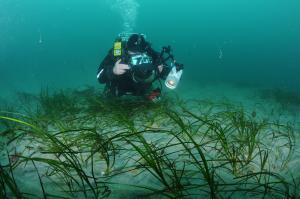
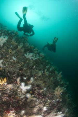
Subtidal surveys

Marine mammal monitoring
Seal monitoring in Northern Ireland mainly consists of counts of the grey seal (Halichoerus grypus) and harbour seal (Phoca vitulina) populations at haul-out sites where the seals rest, moult and give birth to and raise their pups. DAERA Marine and Fisheries Division coordinates the Northern Ireland seal counts undertaken by the NIEA, DAERA Marine and Fisheries Division and National Trust. The Department also carries out aerial thermal imaging surveys.
Site integrity monitoring and compliance
The Department undertakes regular boat and shore based patrols of all MPAs in the Northern Ireland inshore region. Observed and reported instances of disturbance and/or damage to protected habitats and species are investigated when environmental or wildlife offences are suspected. Investigations routinely work closely with regulatory teams within NIEA, Marine Licencing, Sea Fisheries and planning. Patrols will often be coupled with marine mammal surveys and condition monitoring.
Citizen science
Citizen science provides new scientific and environmental knowledge through the involvement of members of the public in scientific research and monitoring. Divers in Northern Ireland are one of the main volunteer groups participating in marine citizen science projects and one of the most motivated marine user groups.
Results and reports
The evidence gathered is used to provide information to support decisions about proposals, management, plans and projects and to fulfil statutory reporting requirements.
To ensure that the most important marine and coastal areas are effectively protected, information gathered is also used to support designations of MPAs.
The Department recommends appropriate methods of management to maintain the condition and integrity of marine ecosystems and ensure its sustainability.
All marine species data collected within the Northern Ireland marine environment are collated and stored by the the Centre for Environmental Data and Recording (National Museums Northern Ireland).
You can view this data on the NBN Atlas Northern Ireland.
Useful links
- MPA Condition Assessments 2019
- Marine Strategy
- Rathlin Island Dive Expedition 2019 : A citizen science project
- Aerial thermal-imaging surveys of Harbour and Grey Seals in Northern Ireland, August 2018. Duck C.D. & Morris C.D. Report for the Department of Agriculture, Environment and Rural Affairs, Northern Ireland
- A review of Northern Ireland seal count data 1992-2017
- Sublittoral Survey Northern Ireland (SSNI) 2006-2012
- Review of Marine Turtles in Northern Ireland (2007)
- Northern Ireland Littoral Survey (NILS) 1984-1988
- Restoration and long-term monitoring of Modiolus modiolus in Strangford Lough
- Assessment of extent and abundance of Maerl beds and their associated biodiversity along the East Antrim coast
- Protected areas
- Searching protected areas
- AFBI report on the mapping of potential sandeel habitat within the Northern Irish inshore region
