Department of Agriculture, Environment and Rural Affairs Department of Agriculture, Environment and Rural Affairs An Roinn Talmhaíochta, Comhshaoil agus Gnóthaí Tuaithe Depairtment o' Fairmin, Environment an' Kintra Matthers

Main navigation

  • Home
  • Topics
  • Publications
  • Consultations
  • Contact

Translation help

Translate this page

Select a language

  • Arabic — عربي
  • Chinese (Simplified) — 中文简体
  • Chinese (Traditional) — 中文繁體
  • Dutch — Nederlands
  • Filipino — Filipino
  • French — Français
  • German — Deutsch
  • Hungarian — Magyar
  • Irish — Gaeilge
  • Italian — Italiano
  • Latvian — Latviešu
  • Lithuanian — Lietuvių kalba
  • Polish — Polski
  • Portuguese — Português
  • Romanian — Română
  • Russian — Русский
  • Slovak — Slovenčina
  • Spanish — Español
  • Ukrainian — Українська
  • Annacloy River

    Topics:
    • Angling and Commercial Fishing (Inland Fisheries), 
    • Fisheries in County Down

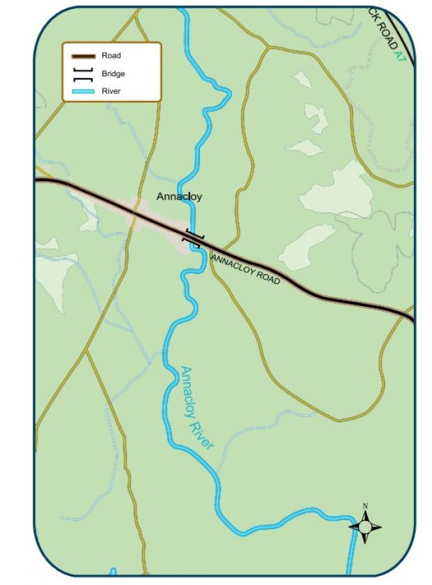
    The Department leases the fishing rights on part of the river from Downpatrick to Kilmore. The Department’s stretches are signposted. Good brown trout fishing is available in the river downstream from Kilmore. Access to the water is easy on the south side where the road runs near the water.

    Key Information

    Fishery TypeGame
    SpeciesBrown Trout, Salmon, Sea Trout
    Season Open1st March
    Season Close31st October
    Rod Licence12 years old and over DAERA Game Rod Licence
    Permit12 years old and over DAERA Game Fishing Permit
    Fishing methodsFly Fishing, Spinning and Worm Fishing
    Bag LimitFour Brown Trout minimum length of 25.4cm. Salmon and sea trout - catch and release only.

    Buy a DAERA Licence, Permit or Day Ticket
    Annacloy River
    Annacloy River

    Car Parking OnsiteNo
    Disabled Car Parking OnsiteNo
    Fishing StandsNo
    Disabled accessible fishing standsNo
    Boats AllowedNo
    Boat RestrictionsN/A

    Click here for location on Google Maps

    Directions

    • From Downpatrick: Head towards Annacloy via the A7 then take a left on the Annacloy Road.
    Local Council AreaNewry Mourne & Down
    Nearest populated areaDownpatrick
    Water TypeRiver
    Water Area / Size11 Kilometres

    Related content

    • Ballykeel Lough Erne
    • Ballynahinch River
    • Boomer's Reservoir
    • Castlewellan Forest Lake
    • Church Road Reservoir
    • Creevy Lough
    • Creightons Green
    • Cypress Pond
    • Hillsborough Lake
    • Lough Brickland
    • Lough Cowey
    • Lough Island Reavy
    • Lough Money
    • Lower Ballysallagh Reservoir
    • Lower Conlig Reservoir
    • Quoile Basin & River
    • River Lagan (Iveagh Stretch)
    • Shimna River
    • Spelga Reservoir
    • Upper Ballysallagh Reservoir
    • Upper Conlig Reservoir (Ross Jord)
    Share this page Share on Facebook (external link opens in a new window / tab) Share on X (external link opens in a new window / tab) Share by email (external link opens in a new window / tab)

    Department footer links

    • Crown copyright
    • Terms and Conditions
    • Privacy
    • Cookies
    • Accessibility
    • The Northern Ireland Executive
    • The Executive Office
    • Department of Agriculture, Environment and Rural Affairs
    • Department for Communities
    • Department for Education
    • Department for the Economy
    • Department of Finance
    • Department for Infrastructure
    • Department for Health
    • Department of Justice
    • nidirect.gov.uk — the official government website for Northern Ireland citizens