The 1st Northern Ireland Countryside Survey
The 1st NI Countryside Survey was based on a series of surveys between 1986 and 1991on the ecology and landscape of NI. It was carried out under contract for Environment Service (DoENI) and was co-funded by the University of Ulster.
These surveys originated as independent studies of Areas of Outstanding Natural Beauty (AONBs). The aim was to provide consistent information on environmental resources as part of the AONB redesignation process. The surveys were subsequently extended to Fermanagh District and the Wider Countryside in order to cover the whole of NI.
NI Land Classification
The NI Land classification was developed using the Maplewood method of multivariate land classification. This involved selecting a sample of 700 1km grid squares, representing 5% of the NI land area. For each of these squares, attributes on climate, elevation & topography, vegetation, hydrology, settlement, geology, and soils were recorded from maps. Using TWINSPAN, this data was used to produce a land classification hierarchy, yielding 23 land classes. This was then used to classify all remaining 1km grid squares in N. Ireland. In total, 14,377 grid squares were assigned to one of the 23 land classes combined into 8 groups.

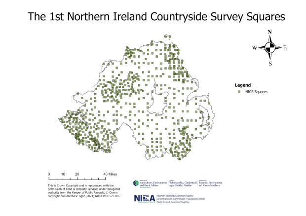
NI Countryside Survey Design
The NI Land Classification was used to randomly select a stratified sample of 628 grid squares, 25 ha in size, representing 1.1% of the land area for the first NI Countryside Survey. Field survey of land cover, ecological resources and landscape features was carried out between 1986-1991. Follow-up vegetation surveys, during 1993 and 1994, recorded the plant species composition of grassland and upland heath/mire land cover types. A quality assurance programme was carried out to assess the reliability of the results and a series of reports was produced detailing the results of these surveys, followed by a summary report drawing all the results together published in 1997.
The habitats and field boundaries of each sample square were mapped using a habitat classification based on plant species composition, vegetation structure and environment in NI.
1st NI Countryside Survey Timeline

Results and Key Findings
Estimates of the abundance and distribution of land use, field boundary and semi-natural vegetation resources were presented for NI as a whole and for each of the eight land class groups. The estimates produced by the NI Countryside Survey provide a baseline against which changes in the distribution, abundance and management of landscape and ecological resources can be measured.
Land Use
The NI Countryside Survey baseline study estimated that productive agricultural land accounted for almost two thirds (63%) of the total land area. Arable land was largely restricted to the lowlands, although it was uncommon in the Lakelands of Fermanagh. Just over half of all agricultural grasslands constituted ryegrass leys. Uncultivated land, which includes all types of semi-natural vegetation, accounted for approximately one quarter of the total land area (333,000ha). Most of this land was used for rough grazing, with more than half of the total area occurring in the high uplands and mountains.

Field Boundaries
There were over 235,000 km of field boundaries in NI, comprising of hedgebanks, earth/stone banks, walls and fences. This represented an average of 17.5km of field boundaries in every square kilometre of countryside. Field boundaries were not a feature of the landscape in mountain areas. Hedgebanks were a particular feature of the lowlands, while earth/stone banks were proportionally more common in the uplands.

Semi-natural Vegetation
Semi-natural vegetation occupied a quarter (25%) of the land area in NI. The greater part of this resource (68%) occurred in the uplands, notably in the high uplands and mountains, where there were still extensive areas of blanket bog and heath. In the lowlands, however, semi-natural vegetation tended to occur as small parcels of land scattered throughout the wider farmed countryside.

Further information
Further information on the NI Countryside Survey methodology and history, as well as other reports can be found in the links below.
Northern Ireland Countryside Survey
The 2nd Northern Ireland Countryside Survey
The 3rd Northern Ireland Countryside Survey
The 4th Northern Ireland Countryside Survey
Publications
NI Countryside Survey Publications
Any queries relating to NI Countryside Survey should be directed to EFS.MEF@daera-ni.gov.uk