Department of Agriculture, Environment and Rural Affairs Department of Agriculture, Environment and Rural Affairs An Roinn Talmhaíochta, Comhshaoil agus Gnóthaí Tuaithe Depairtment o' Fairmin, Environment an' Kintra Matthers

Main navigation

  • Home
  • Topics
  • Publications
  • Consultations
  • Contact

Translation help

Translate this page

Select a language

  • Arabic — عربي
  • Chinese (Simplified) — 中文简体
  • Chinese (Traditional) — 中文繁體
  • Dutch — Nederlands
  • Filipino — Filipino
  • French — Français
  • German — Deutsch
  • Hungarian — Magyar
  • Irish — Gaeilge
  • Italian — Italiano
  • Latvian — Latviešu
  • Lithuanian — Lietuvių kalba
  • Polish — Polski
  • Portuguese — Português
  • Romanian — Română
  • Russian — Русский
  • Slovak — Slovenčina
  • Spanish — Español
  • Ukrainian — Українська
  • Upper Bann River

    Topics:
    • Commercial Fishing and Angling (Inland Fisheries), 
    • Fisheries in County Armagh

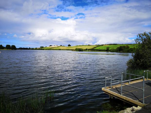
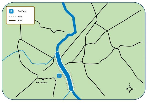
    This stretch of the River Bann extends from Point of Whitecoat to Lough Neagh. Access paths and fishing stands have been provided. Anglers should remember that the river is used for water sports, and courtesy should be exercised at all times. Anglers should be careful not to approach the river at points other than those shown on the map except with the permission of the landowner.

    Key Information

    Fishery TypeCoarse
    SpeciesBream, Hybrids, Perch, Pike, Roach
    Season Open1st January
    Season Close31st December
    Rod Licence12 years old and over DAERA Coarse or Game Rod Licence
    Permit12 years old and over DAERA Coarse or Game Fishing Permit
    Fishing methodsAll Lawful Methods.
    Bag Limit1 Pike (up to 4kg) and 4 coarse fish (up to 25cm) per day may be retained

    Buy a DAERA Licence, Permit or Day Ticket
    Upper Bann River
    Upper Bann River

    Car Parking OnsiteYes
    Disabled Car Parking OnsiteYes
    Fishing StandsYes
    Disabled accessible fishing standsNo
    Boats AllowedNo
    Boat RestrictionsN/A

    Click here for location on Google Maps

    Directions

    • Upper Bann River runs through Portadown.
    Local Council AreaArmagh, Banbridge & Craigavon
    Nearest populated areaPortadown
    Water TypeRiver
    Water Area / Size16 Kilometres

    Related content

    • Carnagh Forest Lakes
    • Clay Lake
    • Craigavon City Park Lake - North
    • Craigavon City Park Lake - South
    • Gentle Owens Lake
    • Loughgall Lake
    • Seagahan Reservoir
    • Stoneyford Reservoir
    Share this page Share on Facebook (external link opens in a new window / tab) Share on X (external link opens in a new window / tab) Share by email (external link opens in a new window / tab)

    Department footer links

    • Crown copyright
    • Terms and Conditions
    • Privacy
    • Cookies
    • Accessibility
    • The Northern Ireland Executive
    • The Executive Office
    • Department of Agriculture, Environment and Rural Affairs
    • Department for Communities
    • Department for Education
    • Department for the Economy
    • Department of Finance
    • Department for Infrastructure
    • Department for Health
    • Department of Justice
    • nidirect.gov.uk — the official government website for Northern Ireland citizens